With a name like Death Valley, you may automatically feel deterred to visit here. And we can’t say we blame you. The visions that pop into our heads when we put the words “death” and “valley” together aren’t exactly pleasant ones.
But just like you should never judge a book by its cover, you should also never judge a national park by its name.
This is especially true when it comes to Death Valley National Park. Not only will this park certainly not kill you, it will do the exact opposite, and rather breathe life into you in a way that you didn’t know possible.
Sound convincing? If you’re still feeling a bit on the fence about this park, read on for the ultimate guide to road tripping your way through it, and by the end, we are guessing you’ll be making your campground reservations for a visit.
What to Know Before You Go to Death Valley
Weather
The weather in Death Valley National Park is no joke. This area holds the record for the hottest temperature ever recorded: a whopping 134F back in 1913. Temperatures during the summer regularly hover around 120 degrees, with night temps dipping to the 90s.
And in the winter, you can expect daytime temperatures to be in the high 60s, low 70s, and for the nighttime to drop to anywhere between the high 30s and the mid 40s. In other words: it gets really cold at night, so be prepared.
We do not recommend going in the summer, as the temperatures are so hot that it becomes dangerous. Instead, opt for sometime between November and March when the temperatures are much more manageable and you can plan the proper clothing to accommodate both daytime and night time needs.
Cell Service
Your phone may or may not work in this park, so be prepared. Download maps you may need ahead of time and don’t get lost from the other people in your party.
We also recommend you download your music, podcasts, and any other forms of entertainment you may want while you’re driving through the park.
Park Size
Death Valley is the largest national park in the contiguous United States, measuring in at 3.4 million acres. That means, depending on how much time you have, you may not be able to see everything on this list. Or, it may mean making your adventures in the park span over a few days rather than trying to pack it all into one.
This also means that the distance between different sights can be long, so make sure you plan your route in a way that works best for you.
Food
Because there aren’t many food options within the park, we highly recommend ensuring ahead of time that you have enough food to last you a while.
While you will come across some great eateries in the park that you must try, you don’t want to be so hungry that you drive way off track to find one of these places. Bring food with you so that you can stay nourished during your trip.
What Sites To See In Death Valley National Park
Death Valley National Park is, as the National Park Foundation states, “America’s lowest, hottest, and driest national park.” That’s a lot of “est”s that sound intimidating.
However, it is the extreme nature of this national park that makes it worth visiting, and makes it an experience you will never forget.
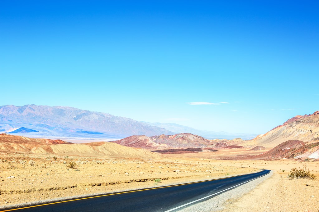
Because Death Valley is such an intense place to visit, unless you are a very seasoned adventurer who comes well-prepared for inevitable dangerous hurdles in your trip, we highly suggest sticking mainly to your car and using this mode of transport to visit the different highlights of the park.
There is much to see here in Death Valley National Park, so let’s get started.
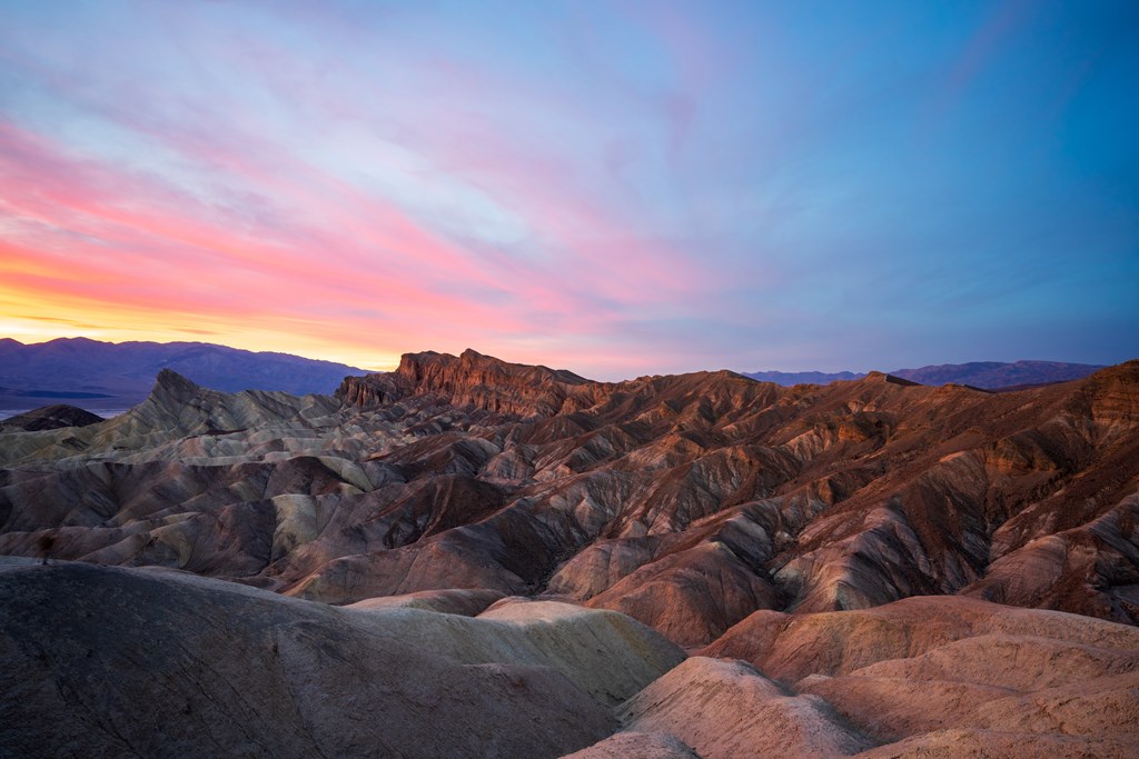
Zabriskie Point
Upon entry into the park (via Highway 190), the first thing you’ll see will be Zabriskie Point. This iconic spot provides a warm welcome to Death Valley National Park, offering up some stunning views that you will regret not capturing with your camera.
Some travelers note this as their favorite spot to catch sunrise, if you’re able to time your visit right. Because Zabriskie Point is only a few miles from nearby lodging, it is not as difficult to get to as some of the other spots in the park.
And what you’ll see here is the definition of “dramatic.” You get a viewpoint that provides a variety of views into the park — from the golden cliffs of Red Cathedral to the striking mountains behind, and much more in between.
There is also the option to do some hiking here, but we recommend doing that only during certain times of the year.
Remember, Death Valley National Park is the hottest national park in the country, and daytime temperatures in the summer average around 115-120 degrees. So hiking is not something you want to do in the warmer months. But the cooler months make for idea hiking conditions.
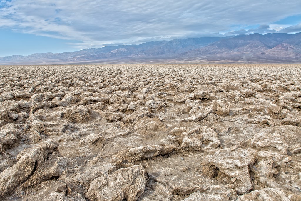
Devil’s Golf Course
Don’t bring your clubs with you thinking you’ll be able to play a round here — Devil’s Golf Course is not an actual course but rather a dried up lake bed — what was once Lake Manly. And it looks like what we would imagine standing on a meteor would look like.
This area is made up of halite salt crystal formations and got its name thanks to a National Park guide that claimed this to be a place that only the devil could play golf.
Prior to Death Valley National Park becoming a protected area in the 1930s, Devil’s Golf Course was mined for a number of resources, but since its protection, this area has been left to run nature’s course, and as a result, has created an incredibly unique experience.
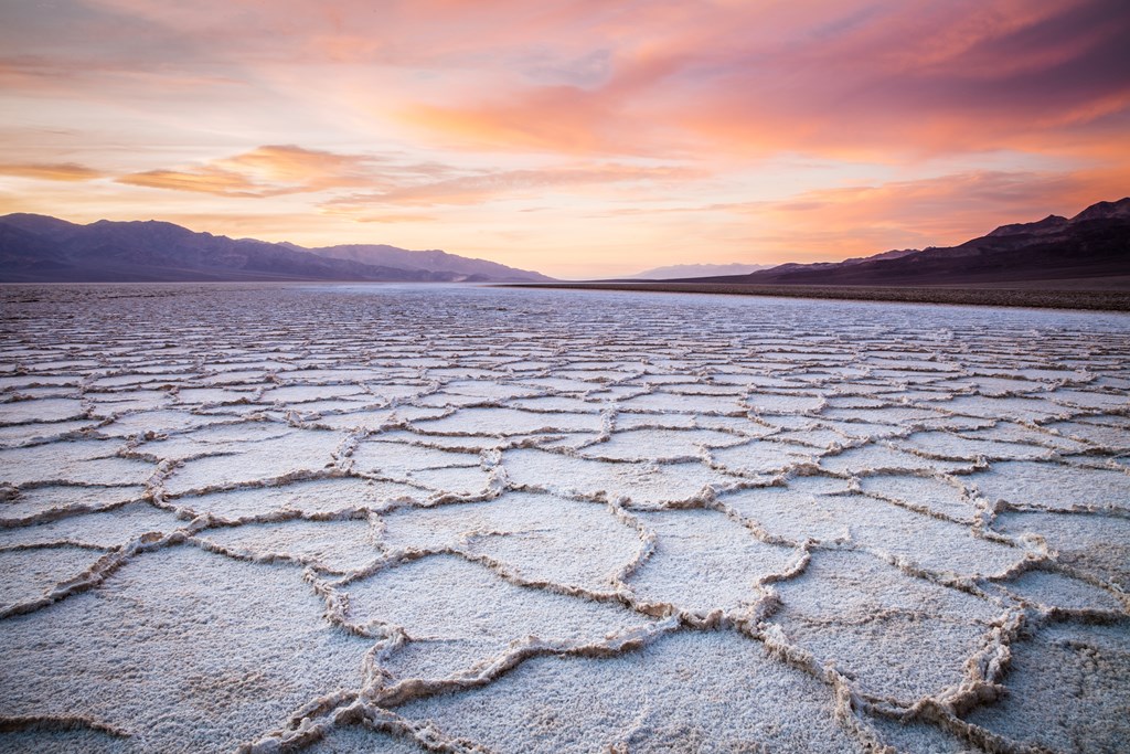
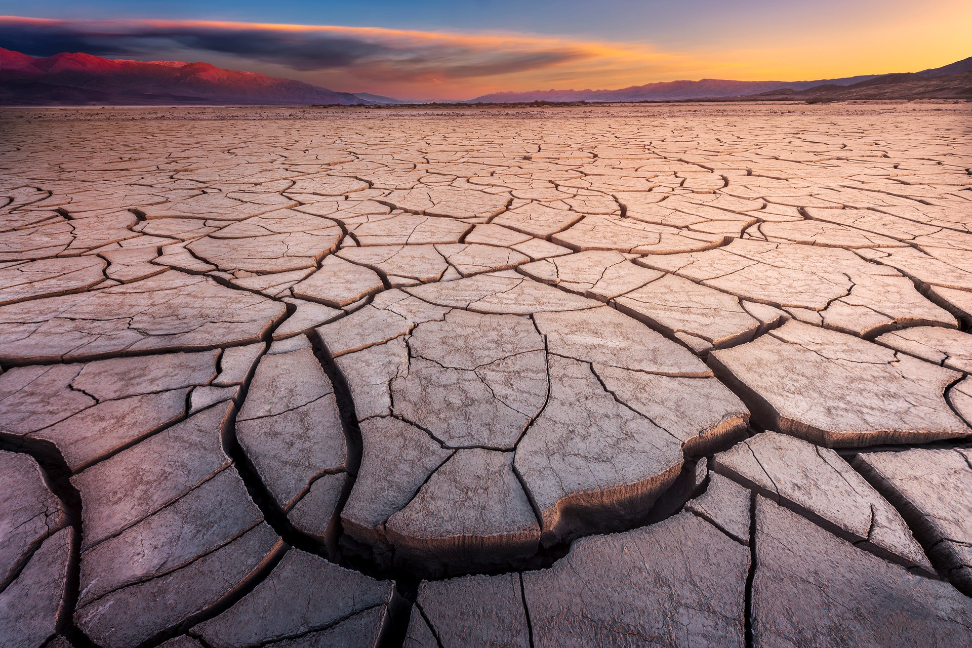
Badwater Basin
Head to Badwater Basin to experience the lowest point in the United States. This spot measures in at 282 feet below sea level, and is a great place for hikers of all levels to explore.
What you’ll likely find most striking about this basin is the geometric shapes that span the salt-covered land. Because water is unable to flow out of the basin, it instead gets stuck and simply evaporates into the air, thus causing this beautiful, photo-worthy shapes.
Natural Bridge Trail
We recommend only heading to this area if you have a vehicle that is high-up and has plenty of clearance. But if this sounds like you, then we highly suggest parking your car (again, only if it is during the cooler months when the daytime temperatures are safe to explore in), and hiking the 1-mile trail.
This hike is quick and easy, but gives you some unique perspectives on this massive national park.
Artist’s Drive and Artist’s Palette
Though you head back towards Badwater Basin to get to Artist’s Palette, it is best to go there after the Natural Bridge Trail because the road (Artist’s Drive) is one-way and you can only travel it going from south to north.
And it is worth it. This 9-mile drive takes you on a winding route through hillsides “painted” with color that will leave you feeling like you stepped into a Dr. Suess book.
Artist’s Palette is a little over halfway down the road, and is a spot you want to stop at. Here you’ll find a group of the colored oxidized rocks that, as you likely guessed, gave it its name of Artist’s Palette.
The hills get their colors due to the different elements present — primarily iron, manganese, and mica.
Don’t wait too long to get here — once the sun sets, much of this area will be out of the light and you won’t get the full effect. Instead, aim to arrive here late afternoon or for sunset, if possible.
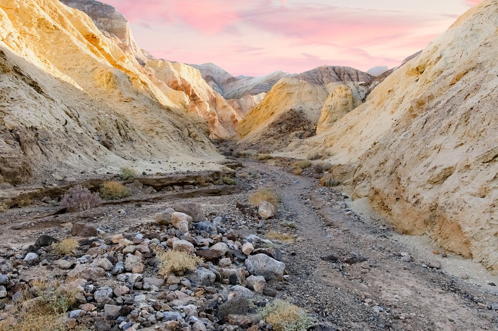
Golden Canyon Interpretive Trail
If you’ve got time for a 6-mile hike, then this is a great way to do it. Golden Canyon Interpretive trail gives you a chance to make your way up to Zabriskie Point, but if you want to loop back to your car, we recommend opting out of the trail division at about 2.5 miles in.
Though most people only make it about a mile up the trail, we suggest continuing further because that’s where the beauty really starts, and it’s also where the crowds dwindle so you have more space to enjoy it on your own.
Remember the Red Cathedral from Zabriskie Point when you first arrived at the park? You’ll have a chance to experience that while hiking on this trail, but it’s going to cost you a one-mile detour.
Or, you can opt to head to Gower Gulch where the landscape chances and you’ll make your way to Manly Beacon — an icon for the park, which also happens to be the most difficult part of the hike.
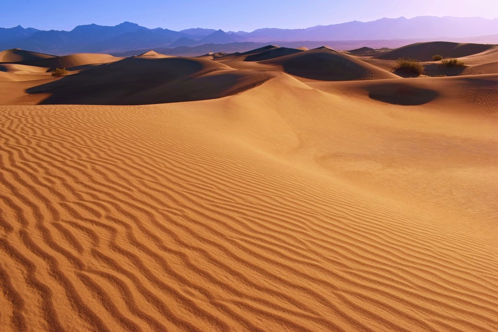
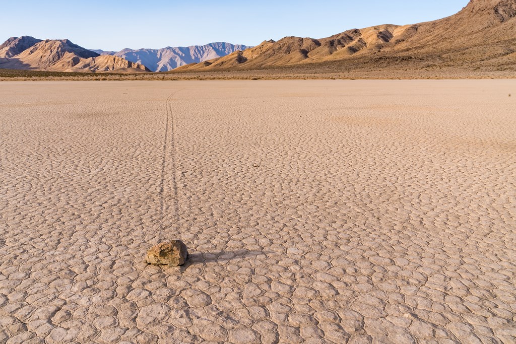
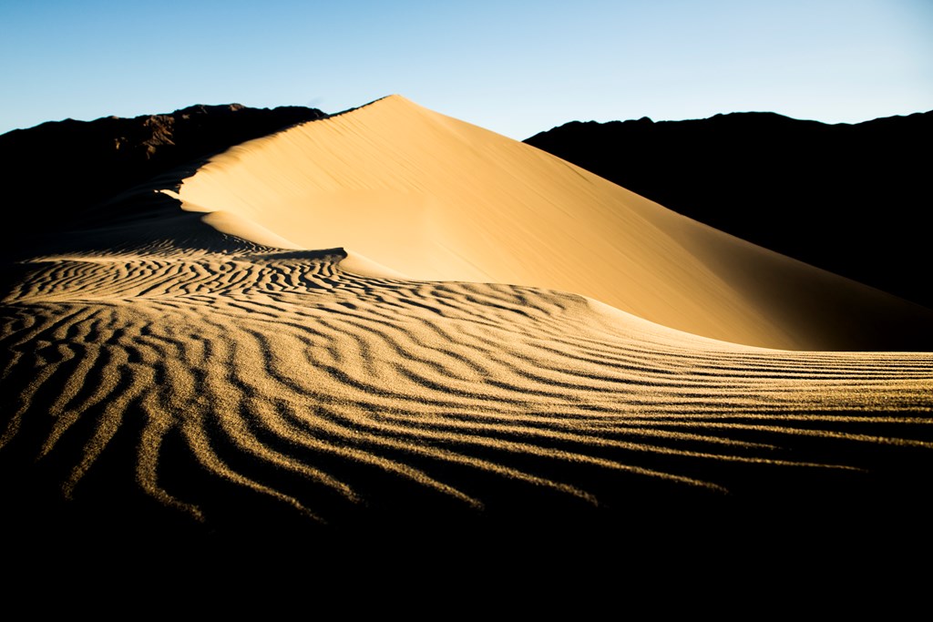
Mesquite Flat Sand Dunes
If you’re a Star Wars fan then you’re going to recognize the Mesquite Flat Sand Dunes immediately upon seeing them. However, you will know them instead as Tatooine.
This massive space on sand will have you feeling as if you’ve transported to a completely different world, and a world in which you don’t know which way to go. There are no trails to be found in these sand dunes because the sands are constantly shifting. So, that means it’s up to you to pave your own way and explore as far and wide as you feel fit.
Head here around sunrise or sunset to see the colors bounce off the sand in a way that will truly “wow” you. And while we love a good night adventure through these dunes, do be careful of rattlesnakes who also like to travel these grounds at night in the summertime.
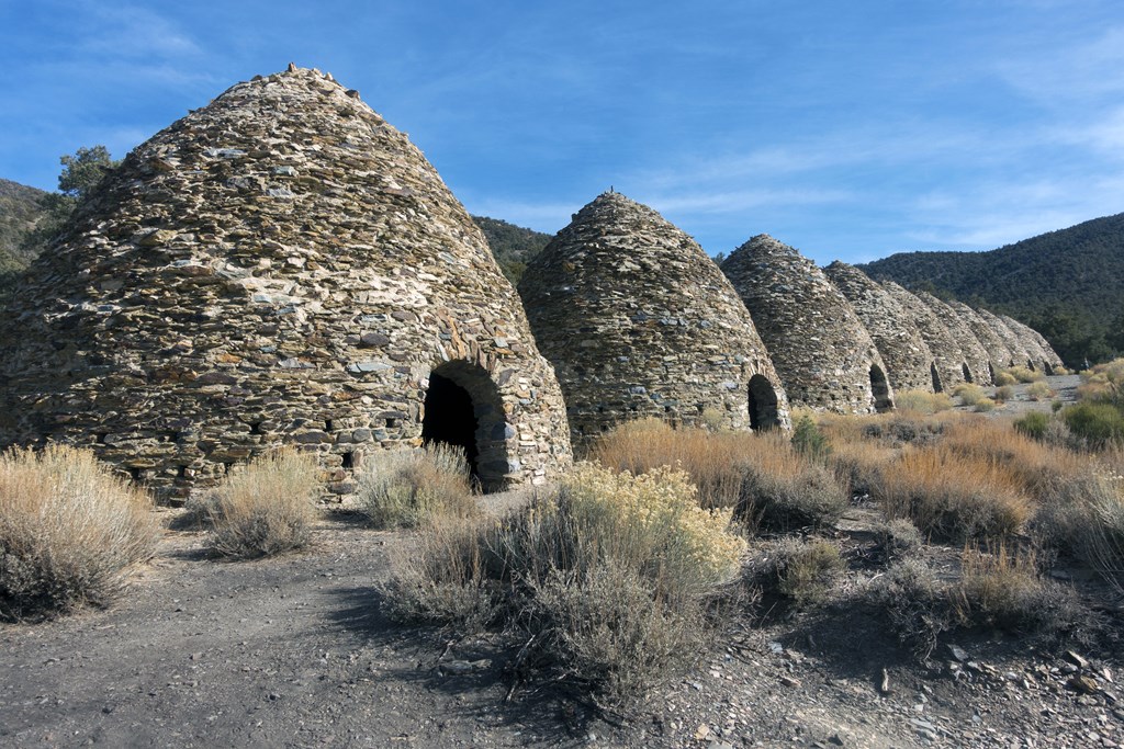
Wildrose Charcoal Kilns
Just when you thought you couldn’t possibly see anymore unique things in Death Valley National Park, you come across the Wildrose Charcoal Kilns and think “what the heck?”
No, these are not structures created by beings of another planet — they instead were built by the Modoc Consolidated Mining Company to make charcoal from the area’s pine logs. However, after only being used for 2 years, the mines in the area were shutdown, leaving the abandoned kilns behind.
Now, they serve as a great and unique sight for visitors to the park to explore.
Eureka Mine
Make you way back to the Mesquite Sand Dunes, and on the way, hit Eureka Mine.
While most of the park’s abandoned mines are closed to visitors, this one has been stabilized and is in condition for people to come and check out. Though the road is a bit bumpy, it’s worth it to check out what’s at the end.
We suggest taking advantage of visiting the few mines in the park that you can — Death Valley National Park has the most abandoned mines of any national park in existence.
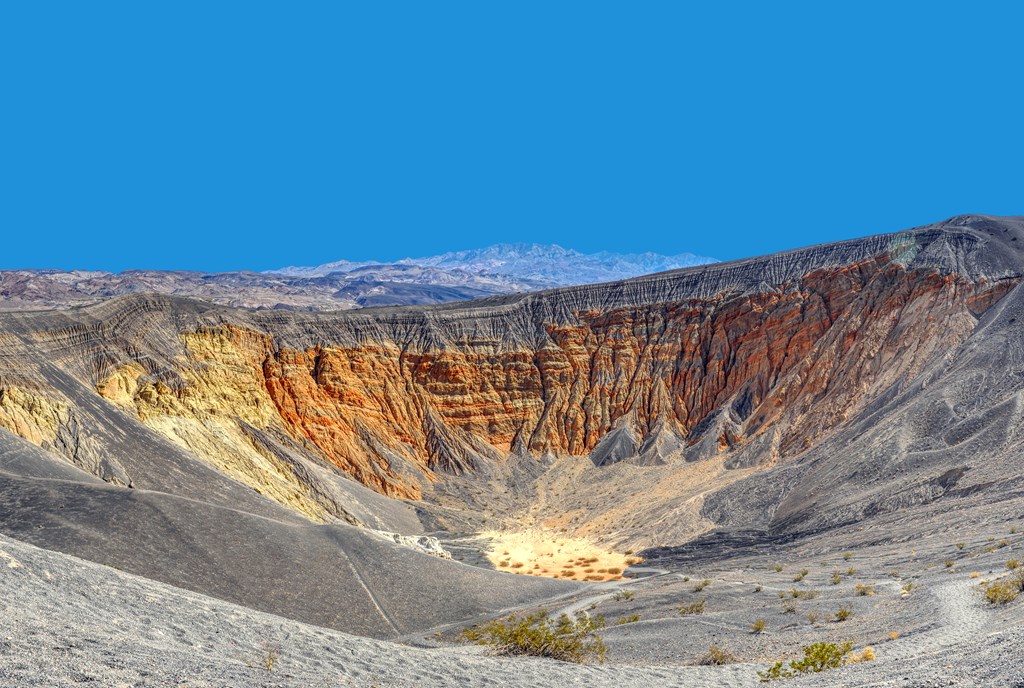
Ubehebe Crater
It is estimated that around 300 years ago, this area exploded, leaving behind a 600-foot deep crater that is definitely worth a visit. This crater boasts a colorful palette and can be seen easily from the road. However, if you want to get more up close and personal with it, then hop on the trail that follows the crater’s southwest rim. Along the way you’ll come across other craters that existed before Ubehebe was created.
Eureka Sand Dunes
You don’t want to miss checking out the tallest sand dunes in California and what are also thought to be the tallest sand dunes in North America: Eureka Sand Dunes.
These dunes are easy to access from the main road and are worth the quick turnoff.
Not only are these sand dunes a sight for sore eyes, if you are lucky you may be able to catch the sands “singing.”
Wait, what?
Yes, singing. “Singing sands” is a real phenomena that happens when the sand grains make a loud sound that resembles a small plane passing by. It seems strange, yes, so you’ll have to go check it out for yourself.
Now if that doesn’t sound like a one-of-a-kind national park experience, we aren’t quite sure what does.
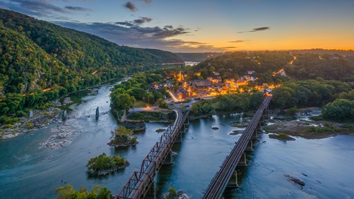
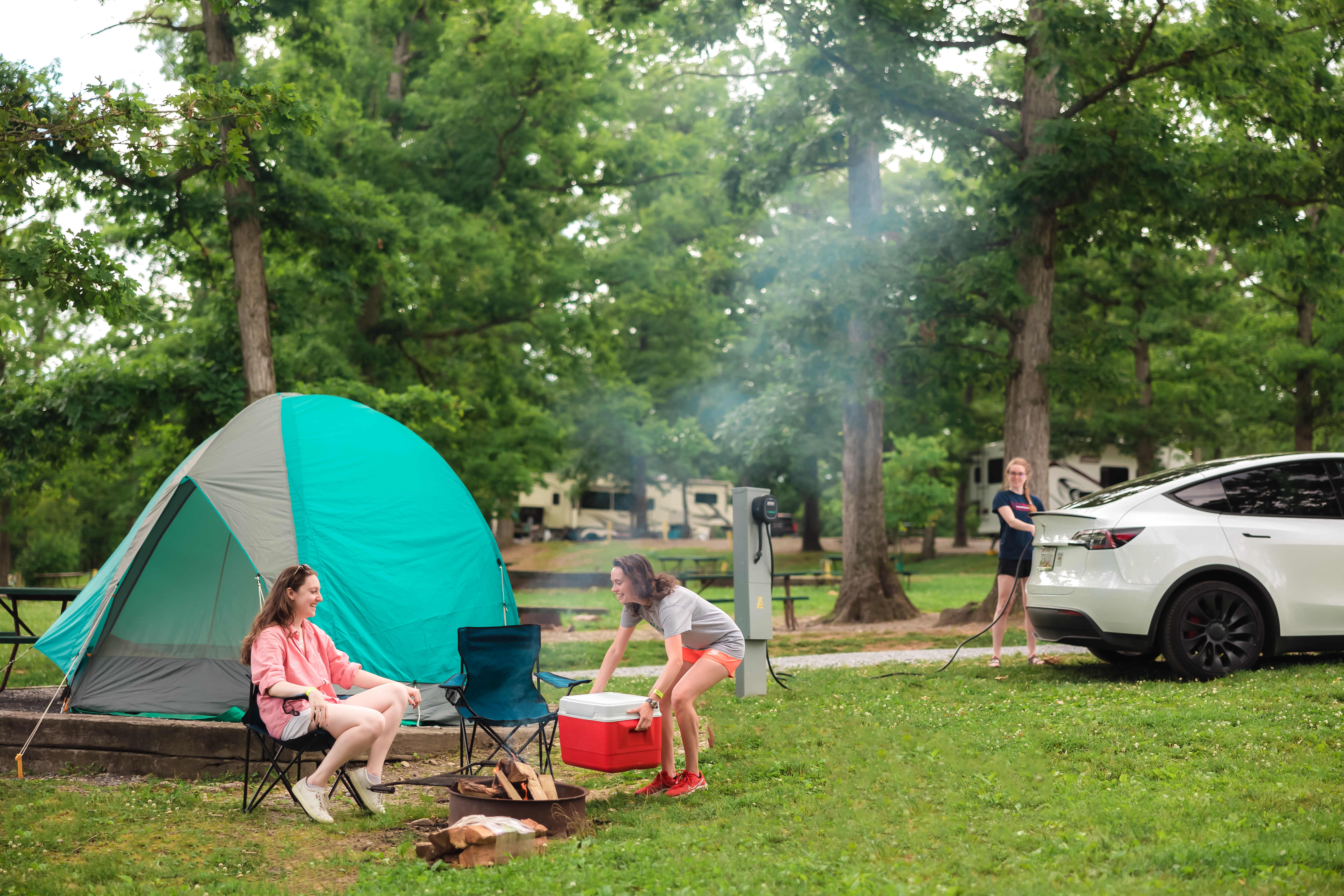
And among all the weirdness, unique sights, tricky travels, and adventures, you can find comfort in KOA. During your Death Valley National Park visit, call KOA home at either the Lake Isabella / Kern River site, or the Las Vegas KOA Journey at Sam’s Town. You’ll get a chance to explore the park, and then find somewhere safe to rest your head for the night.
Ready to start planning your Death Valley National Park Adventure? Book your KOA campground today and let the exploring begin!

Leslie is a freelance travel and health/wellness writer who gets butterflies from telling stories and sharing information with readers across the globe. Her voice comes from a place filled with passion and dreams.
With over 10 years of experience in crafting words and years of embarking on travels that have taken this Montana girl to some incredible places, Leslie loves the adventures of both body and mind her writing takes her on.
To see what Leslie’s up to in the writing and design world, visit her website here.