
Finding a great place to hike near Cedar City, Utah, is easy. With so many trails of various challenge levels, there is a hike for everyone looking for an adventure or a peaceful escape from the city. You can journey through stunning red rocks, scramble over boulders, venture through tranquil streams and enjoy incredible views when you hike in this unforgettable area.
Cedar City Geography and Weather
Cedar City’s geography consists of steep mountains and flat, open desert areas. The weather changes throughout the season, so you can expect warm, dry summers and crisp fall weather. July through April are the most common months for precipitation, and winters are typically snowy. Summer is the best time to hike in Cedar City because you can enjoy the sunshine, clear skies and longer daylight hours.
Tips for Hiking in and Around Cedar City
Preparing for a hike helps you create a safe, enjoyable experience. Consider the following tips before setting out on your hiking excursions:
- Take plenty of water.
- Wear comfortable, waterproof shoes or hiking boots.
- Avoid trails in inclement weather, such as heavy rain, thunderstorms or snow.
- Check if trails require permits before arriving.
- Take money to pay entrance fees if you plan to hike in a national park area.
Best Hiking Trails Near Cedar City, Utah
Cedar City is a short drive from some of Utah’s most beautiful trails. From leisurely strolls you can take with small children to challenging adventures among stately red rocks, the area is full of fun and serene journeys. The following recommendations are some of the best hiking trails near Cedar City:
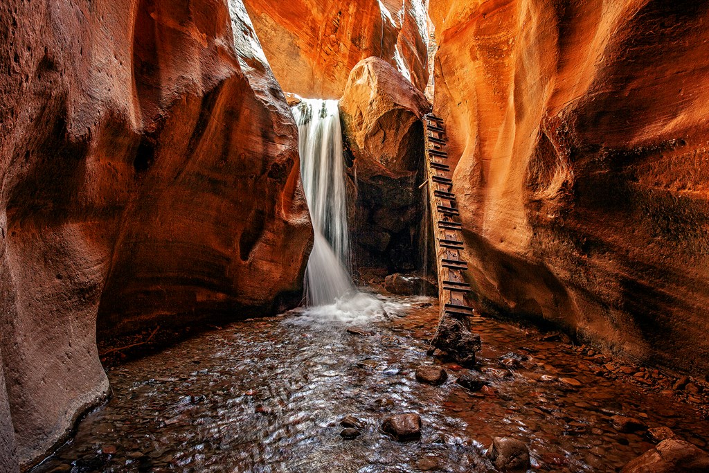
1. Kanarra Falls
If you are looking for waterfall hikes near Cedar City, Kanarra Falls is an unforgettable trail full of majestic slot canyons and spectacular waterfalls. Many hikers consider it an exciting and less-crowded alternative to Utah’s highly popular Narrows hike. This trail is much quieter than the Narrows because Kanarraville limits the number of hikers per day. You can purchase a permit online to enjoy its peaceful serenity.
Challenge Level: Moderate
Kanarra Falls is a moderate trail with some scrambling sections and creek crossings. Waterproof or water-resistant footwear is ideal so you can hike easily and comfortably.
Where to Find Kanarra Falls
A 20-minute drive south of Cedar City takes you to Kanarraville. If you turn east at 100 North and continue a few blocks toward the water tank, you can find the designated parking lot.
How Long is Kanarra Falls Trail?
Kanarra Falls Trail is 4 miles out and back. Plan to carve a few hours out of your day for this hike so you have plenty of time to explore and enjoy the views.
2. Cedar Canyon Trail
Cedar Canyon Trail features a beautiful human-made waterfall at its endpoint. This trail is popular for hiking, biking, running and birding, but it is also a great path for solitude during the morning and late afternoon hours.
Challenge Level: Easy
Cedar Canyon Trail is a great route if you prefer easy hikes near Cedar City. This paved path has some bumps and cracks, but it is accessible and has a gentle grade. Individuals with wheelchairs, strollers or mobility equipment can take the trail but may need assistance with some slightly steeper sections.
Where to Find Cedar Canyon Trail
To hike the Cedar Canyon Trail, make your way to the Ann J. Gardner Canyon Park West parking lot. After walking across the park and crossing the stream, you can find a trail sign and the paved path to the right.
How Long Is Cedar Canyon Trail?
Cedar Canyon Trail is 2.7 miles out and back. It typically takes a little under an hour to complete, so it is the perfect option if you are hiking with small children or want to complete a quick hike before the sun sets.
3. Coal Creek Trail
Coal Creek Trail connects to the Cedar Canyon Trail, and it is a paved, accessible path like Cedar Canyon. This asphalt trail takes you along a river and past serene parks where you can enjoy gorgeous views of the city and mountains.
Challenge Level: Easy
Similar to Cedar Canyon Trail, Coak Creek Trail is an easy hike. It is perfect for beginner hikers, small children and individuals with mobility equipment.
Where to Find Coal Creek Trail
Coal Creek Trail begins in Bicentennial Park, but you can start walking it from any of its several access points. The path continues past the city’s ball fields, through Rotary Centennial Veterans Park and East Canyon Park, and then into Cedar Canyon.
How Long Is Coal Creek Trail in Cedar City?
Coal Creek Trail is 3.4 miles out and back. It typically takes less than two hours to complete, but this time depends on your pace and how many times you stop to rest on a bench or take in the views.
4. Red Hollow
Red Hollow Trail is a fantastic option if you want a hike with a little more of an incline and great views. The far right side of a junction in the trail leads to Thor’s Hideout, which is a gorgeous lookout point. You can also take any of the other connecting trails to reach Thunderbird Garden, which is a set of unique sandstone rock formations.
Challenge Level: Moderate
With an elevation gain of more than 800 feet, Red Hollow Trail has a moderate challenge level. This is a good trail if you are taking dogs or children with you, but it is important to note that there are some steep inclines.
Where to Find Red Hollow Trail
To find the Red Hollow Trailhead, take Highway 14 East of Cedar City. The trailhead is approximately a mile up Cedar Canyon, and you can park in the dirt parking area. Across the highway, you can see Cedar City’s paved trail system.
How Long Is Red Hollow Trail?
Red Hollow Trail is 3.3 miles round trip. You can complete this trail in approximately two hours, depending on your pace and how many times you stop to enjoy the views.
5. Fiddlers Canyon Trail
Fiddlers Canyon Trail is a beautiful, low-populated trail in the Cedar City area. This path takes you to a stunning overlook point, and you can expect to see plenty of wildflowers along the way if you hike during the spring or early summer months.
Challenge Level: Easy
Fiddlers Canyon Trail is an easy and short hike. It’s paved and makes for an excellent relaxing walk.
Where to Find Fiddlers Canyon Trail
To reach Fiddlers Canyon Trail, begin from the north of Main Street and turn east on Nichols Canyon Road to continue onto Cottontail Road. Once you are on Cottontail Road, continue for half a block and access the trail on the right. You can also turn left at Bridgewater Road off Cottontail to reach the trail.
How Long Is Fiddlers Canyon Trail?
As a 0.77-mile hike, you can complete Fiddlers Canyon fairly quickly. With so many incredible views, you should give yourself some extra time to complete this hike so you can pause to soak in the beautiful surroundings and take some pictures.
6. Taylor Creek Trail
Hike the Taylor Creek Trail for incredible views at Double Arch Alcove. This trail is popular, so you can expect to meet other friendly hikers along the way.
Challenge Level: Moderate
Taylor Creek Trail has a moderate challenge level. It has a steep start with an elevation gain of 450 feet but turns into a level, sandy path through the canyons. You will cross a stream several times, so waterproof footwear is beneficial.
Where to Find Middle Fork Taylor Creek Trail
If you travel via Interstate 15, you can take Exit 40 and turn eastward to follow Kolob Canyons Road past the visitor center. After passing the Kolob Canyons Visitor Center, proceed for 2 miles until you reach the trailhead.
How Long Is Middle Fork Taylor Creek Trail?
Middle Fork Taylor Creek Trail is a 5-mile round-trip hike. You can expect to complete it in approximately three to four hours, depending on your pace.
7. Timber Creek Overlook Trail
If you want a shorter trail in the Kolob Canyons, Timber Creek Overlook Trail is a quick hike that offers breathtaking views of the canyons, Pine Valley Mountains and Kolob Terrace. If you hike this path in the spring and early summer season, you can also enjoy gorgeous desert wildflowers and have a picnic a short distance from the trailhead.
Challenge Level: Easy
Timber Creek Overlook Trail has a slight incline and some small rocky sections, but it is an easy hike. It is an open area, so wear plenty of sunscreen and drink water while you explore.
Where to Find Timber Creek Overlook Trail
The trailhead for Timber Creek Overlook Trail is in the Kolob Canyons Viewpoint parking lot. Take Exit 40 off of Interstate 15, and follow Kolob Canyons Road for approximately 5 miles.
How Long Is Timber Creek Overlook Trail?
Timber Creek Overlook Trail is a 1-mile round-trip hike. You can complete this trail in approximately 30-60 minutes, but it is a great opportunity to pause and take in the views.
8. Spring Creek Canyon
Spring Creek Canyon is an excellent excursion if you are looking for an adventure. This trail begins in a beautiful open area and continues through stunning red rock formations. You can trek between towering, wavy rock walls and enjoy some rock scrambling toward the end of the trail.
Challenge Level: Moderate
Spring Creek Canyon has a moderate challenge level, so it makes a great challenge for intermediate to experienced hikers. It involves several creek crossings, so wearing waterproof or water-resistant footwear is ideal. It has a slight elevation gain, as well as some uphill and downhill sections and some boulders to scramble over.
Where to Find Spring Creek Canyon
The Spring Creek Canyon trailhead is in Kanarraville, which is approximately 20 minutes from Cedar City. You can take Old US Highway 91 from I-15 and then continue to Spring Creek Road to reach the trailhead.
How Long Is Spring Creek Canyon Trail?
Spring Creek Canyon Trail is 5.5 miles out and back, but it is still exciting if you complete a small portion of the trail. Approximately one-half mile into the hike, you can find a fun slot canyon section and wander between narrow rock walls.
9. Lion’s Mouth Cave
Hiking to Lion’s Mouth Cave is a quick, fun excursion for hikers at all experience levels. This adventure features a small alcove with petroglyphs, providing a glimpse into the area’s history. As you continue past the alcove, you can do some rock scrambling and step onto large rocks overlooking the surrounding area of Cedar City and Enterprise.
Challenge Level: Easy
This hike to Lion’s Mouth Cave has a slight incline and a small rock-scrambling area, but it is a fairly easy adventure for all hikers.
Where to Find the Trail to Lion’s Mouth Cave
The Lion’s Mouth Cave trail is approximately 20 miles from Cedar City. To reach the trailhead, take Utah State Route 56 (UT-56) and turn left onto Pinto Road. Continue on this road for a little over 1 mile until you see a pull-off area on the right side.
How Long Is the Lion’s Mouth Cave Hike?
The hike to Lion’s Mouth Cave is a little under 1 mile out and back. You can expect to complete it in approximately 20 to 30 minutes, depending on your pace and stops.
10. Spectra Point Trail to Ramparts Overlook
Cedar City is also close to Brian Head, Utah, where you can hike the Spectra Point Trail and experience the Ramparts Overlook. On this path, you can witness dazzling cliffs, an awe-inspiring natural amphitheater and unique rock formations that have been eroding over millions of years.
Challenge Level: Moderate
Hiking Spectra Point Trail is a moderate challenge because it takes you to high altitudes. This path is an exciting adventure if you enjoy uphill hiking and gorgeous views. However, you can shorten your hike if you want to enjoy the views with a less challenging trek. Each viewpoint offers an incredible experience — even if you turn around before making it to the top.
Where to Find Spectra Point Trail
To reach Spectra Point Trail, take UT-14 for approximately 18 miles, and turn north on UT-148 toward Panguitch Lake and Cedar Breaks. Continue 4 miles until reaching the Cedar Breaks National Monument, pay the entrance fee to the left of the visitor center and look for the Spectra Point Trail sign from the parking lot.
How Long Is Spectra Point Trail?
Spectra Point Trail is a 2-mile round-trip hike. Give yourself or your group approximately an hour to complete it, and add time if you plan to stop and take in the views along the way.
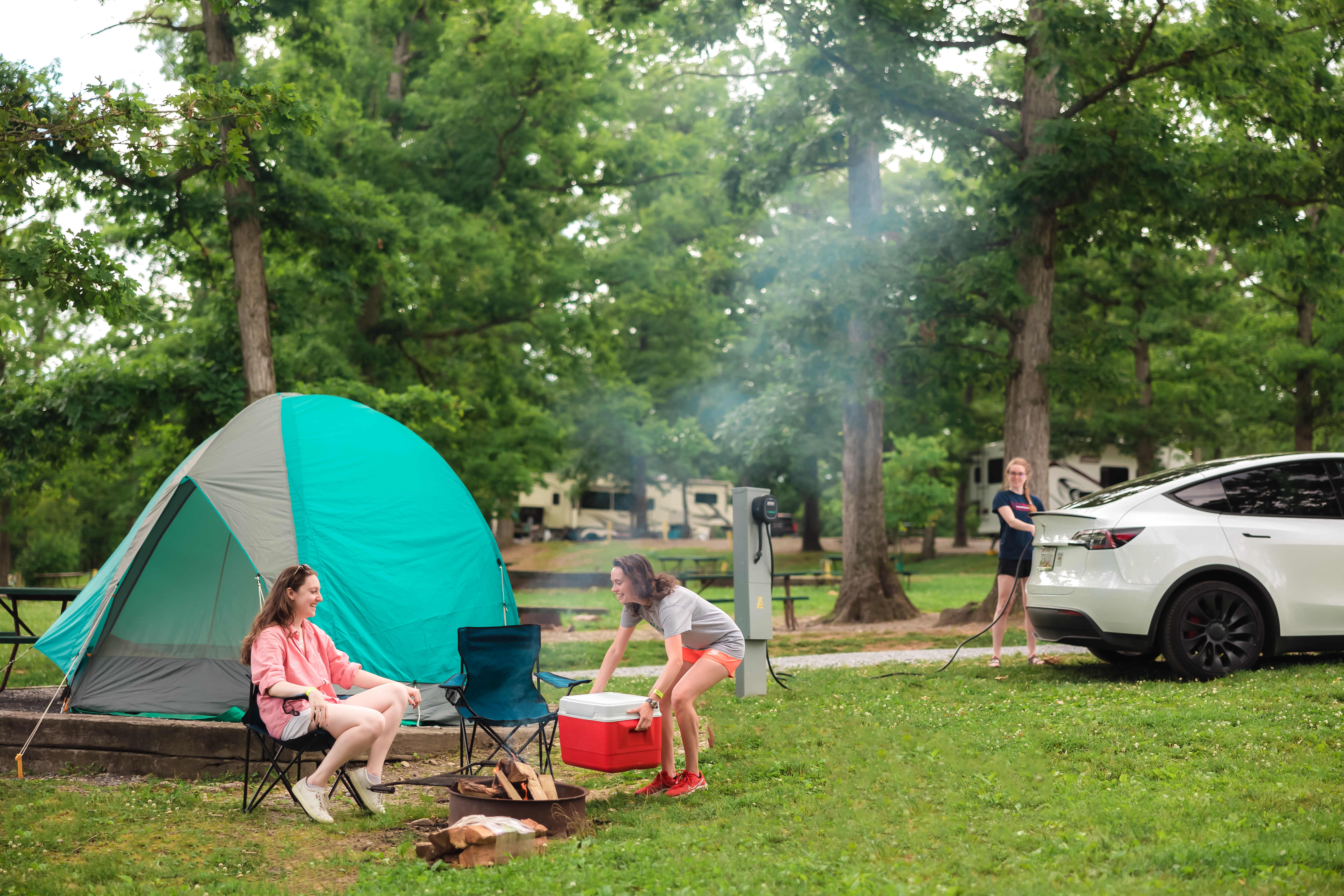
Stay at Kampgrounds of America to Explore the Best of Cedar City
Cedar City hiking trails are full of exciting rock scrambles, awe-inspiring slot canyons, picturesque views and rushing waterfalls. KOA offers tent, RV and cabin camping in over 500 locations across North America, including southern Utah. When you stay at KOA, you can spend your days hiking unforgettable trails and your nights gathered around a warm, glowing campfire.
Beaver KOA Journey and St. George / Hurricane KOA Journey provide a relaxing, fun place to sit around a campfire, enjoy recreational activities and sleep under the stars after exploring Cedar City’s top trails. Reserve a stay at KOA to start your Cedar City hiking adventure.
About the Author: Kampgrounds of America
Kampgrounds of America is the largest system of open-to-the-public campgrounds in the world, with over 500 locations across the United States and Canada. Founded in Billings, MT in 1962, KOA’s family of campground brands – KOA Journey, KOA Holiday and KOA Resort – today serve more than a million camping families each year. KOA is dedicated to “connecting people to the outdoors and each other” by providing people with a variety of camping experiences and the information they need to make the most of their camping trip. Read more of their camping and travel resources by visiting KOA.com/blog.