Your cart is empty!
Make checkout easy by booking all your reservations at once. Add your sites from different campgrounds into your shopping cart* and then choose checkout.

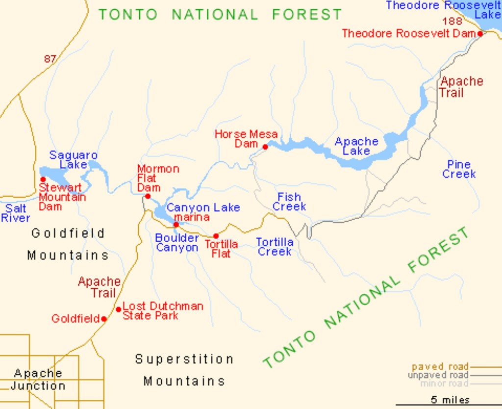
The Apache Trail, or AZ 88 as it is officially known, is part of a scenic byway that was opened to the public in 1922. The Trail location is now a historical landmark. It is part of a 120-mile-long (190 km) "circle trail" that began and ended in Apache Junction. Most of the Apache Trail is unpaved and turns into a dirt road a few miles north from Tortilla Flat and continues for nearly the full remainder of its length. The Trail winds steeply through 40 miles (64 km) of rugged desert mountains, past deep reservoir lakes like Canyon Lake and Apache Lake. The narrow, winding road is unpaved from just east of the town of Tortilla Flat to Roosevelt Dam and includes steep cliff drops and very few safety barriers. The trail requires caution when driving and it is not recommended for large RVs, SUVs, or caravans. When 6” of water was dumped within hours by Tropical Storm Lorena in 2019, massive landslides between the Fish Creek Hill Overlook and Apache Lake Marina occurred causing the middle section of the Trail to close indefinitely. Drivers can access Tortilla Flat from the west. Access to Apache Lake is only possible from the east.
That doesn't mean this area has to always be empty. When you start reviewing camping options, your history will display here to help compare sites and find the best stay. You will be able to share your stay information with friends or family and save it for a later time if you have a KOA Account.
Make checkout easy by booking all your reservations at once. Add your sites from different campgrounds into your shopping cart* and then choose checkout.