Your cart is empty!
Make checkout easy by booking all your reservations at once. Add your sites from different campgrounds into your shopping cart* and then choose checkout.
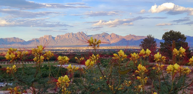
Mesilla ("Little Tableland") is the best-known and most visited historical community in Southern New Mexico. Since its' beginning, around 1848, Mesilla has had a major influence on the economic, cultural, historical, and political life of the Mesilla Valley. From the Gadsden Purchase, to the Civil War, to the Butterfield Stage Coach Trail, to the trial of Billy the Kid, to being a lively social center in the 1880s--Mesilla has been a prominent part of the rich history of the Southwest.
At the northern end of the Chihuahuan Desert lies a mountain ringed valley called the Tularosa Basin. Rising from the heart of this basin is one of the world's great natural wonders - the glistening white sands of New Mexico.
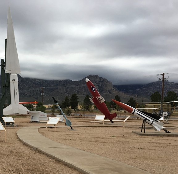
More than 50 items on display with a variety of missiles and rockets tested at White Sands including everything from the WAC Corporal and Loon to a Pershing II and Patriot. Open year-round, admission is FREE.
This $7.4 million museum celebrates the 3000 year agricultural story of New Mexico...from the first farmers in their rustic pithouses more than 1200 years ago to the modern day technology which is helping New Mexico be a leader in the dairy industry.
4100 Dripping Springs Rd
Las Cruces, NM 88011
Dripping Springs is an amazing wildlife viewing opportunity with 4 miles of easy hikes. The Center is open to the public from 8 a.m.-5 p.m. daily except on Thanksgiving and Christmas. The preserve is open from 8:00 A.M. to sunset year round. Day use fees apply on a per vehicle basis. As water finds its way to the surface year-round, Dripping Springs is a desert oasis where unique animal species thrive including Red-Tail Hawk, Gambel's Quail, Golden Eagle, Rock Squirrel, Black-Throated Sparrow, Ladder-backed Woodpecker, Verdin, Black-tailed Gnatcatcher, Lesser Nighthawk, Desert Mule Deer and Coyote to name a few. Another good hike from the Visitor Center takes you up to the ruins of Major Eugene Van Patton's Camp, built originally in 1872, later to be a tuberculosis sanatorium in the early 1900s.
NMSU is the state's land-grant institution with more than 23000 graduate and undergraduate students on the main campus and four branch campuses. Visit New Mexico State University online for more information.

Host to a permanent local historical exhibit and changing cultural exhibits, as well as educational programs, classes, and other special events. The center is located in a building listed on the National and State Registries of Historic Buildings.
501 N Main Street
Las Cruces, NM 88001

The museum includes over 5000 square feet of multi-use exhibition space. Features traveling exhibits of contemporary art with both regionally or nationally-known artists. An extensive art studio class program is run by the museum for all ages. Visit the Las Cruces Museum online for more information.
491 N Main Street
Las Cruces, NM 88001

The LCMNH Education Department's mission is to develop programs and educate the southern New Mexico community in various subject areas of natural history and science. Come and experience science and the natural history of the Chihuahuan Desert up-close and hands-on at the Las Cruces Museum of Nature & Science. Our education staff is skilled and experienced in working with, and involving, people of all ages. Join us for a fun and educational museum experience.
411 N Main Street
Las Cruces, NM 88001

Located in an historic Santa Fe Railroad Depot. Rich in Las Cruces railroad history and provides knowledge on the impact of the railroad on Southern New Mexico.
351 N Mesilla Street
Las Cruces, NM 88005

A privately owned and operated museum with a collection that includes Billy the Kid jail, Gadsden Purchase, Native American Art, and Deerskin Paintings. Museum is open Wednesday through Saturday, by appointment only.
1875 W Boutz Rd
Mesilla, NM 88005

A park located along the western bank of the Rio Grande River and 1.5 miles southwest of the town of Mesilla. The park encompasses 52 acres of floodplain known as the "Old Refuge," as well as 945 acres of wetlands and Chihuahuan Desert . Bird-watching tours, ranger-led nature walks, and children's activities are available. The goals of this park are conservation, education, restoration and protection of natural and cultural resources.
5000 Calle del Norte
Mesilla, NM 88046

Located on Route 70, visit Alamogordo at the base of the Sacramento Mountains and The New Mexico Museum of Space History.

Find skiing just 86 miles northeast of Las Cruces KOA. Take Route 70 to Alamogordo, then head east on Route 82. For ski information, visit New Mexico Snow Skiing online.

Surrounding Area Courses

Visit the Oldest Wine Producing Region in the U.S. The first Spanish explorers and settlers, beginning in the early 1500's, brought their European wines grapes with them as they made the sunny, fertile Rio Grande valley their new home. These original grape stocks remain the source of many of New Mexico's vintners to this day. In the 1580s, Missionary priests were busily producing sacramental wines. By the 19th century, vineyards and wineries dotted the Rio Grande valley from Bernallilo south to the Mexican border. Census data in 1880 identified 3,150 New Mexico acres dedicated to producing 905,000 barrels of wines per year. During prohibition, legal wine production ceased. New Mexico wineries made a resurgence in the early 1980's. Currently, over 5,000 acres are under cultivation as the U.S. rediscovers the bounty of Rio Grande wine country.

Located on Hermosa Street behind the Meerscheidt Recreation Center. Dog park provides water and two shaded areas with chairs for people to relax which their critters make new friends.

A working ranch west of Las Cruces. The ranch is ideal for riding, photographing and exploring, with more than 1,000 square miles of hills and canyons, old ranching ruins, and historical landmarks.
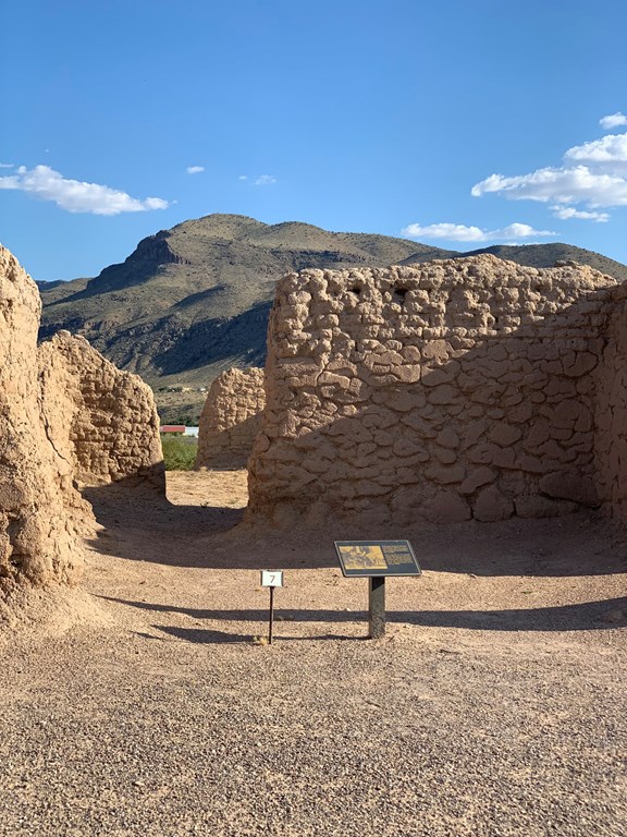
Fort Selden, established in April, 1865, was the protectorate of the southern tip of the Journada del Muerto and the military road to the west. Its strategic location along the Rio Grande helped it perform its job superbly.
1280 Fort Selden Rd
Radium Springs, NM 88054

Leasburg Dam State Park offers year-round camping, picnicking and bird watching. From about mid-March through mid-October, the park also offers fishing, canoeing and kayaking in the Rio Grande. The dam channels water from the Rio Grande for irrigation in the Mesilla Valley. Nearby Fort Selden State Monument has a museum and trails at the site of a 19th century army outpost.
12712 State Park Rd
Radium Springs, NM 88054
Palomas is located 50 miles west on I-10 to Deming, south on Rt.11 to Columbus, and 3 more miles south to the border. There's free parking on the U.S. side. Park and walk over. This town, much smaller than Juarez, also offers shopping, dining, dental and medical services. Enjoy margaritas and an awesome meal at the Pink Store while shopping for trinkets to bring home.

On March 9, 1916, the soldiers of General Francisco "Pancho" Villa attacked the small border town and military camp at Columbus, New Mexico (south of Deming at the border of Palomas, Mexico). Pancho Villa State Park contains extensive historical exhibits which depict this raid, the first armed invasion of the continental United States since the War of 1812, and also the last one.
400 West Highway 9
Columbus, NM 88029
About one hour from Las Cruces, takes its name from the incredible rock formations formed of volcanic ash 30 million years ago and sculpted by wind and water into rows of monolithic blocks. Cactus gardens and hiking trails add to this unique destination. The rock formations at the park are so unique that they are only known to exist in six other places in the world. Imaginative visitors may see the rock formations as a small city, complete with houses, chimneys, courtyards, and streets.
327 Hwy 61
Faywood, NM 88034

Located one hour west on the rugged west slope of the Little Florida Mountains, Rockhound State Park is a favorite for "rockhounds" because of the abundant agates and quartz crystals found there. Hiking trails provide spectacular views of the surrounding landscape.
9880 Stirrup Rd SE
Deming, NM 88030
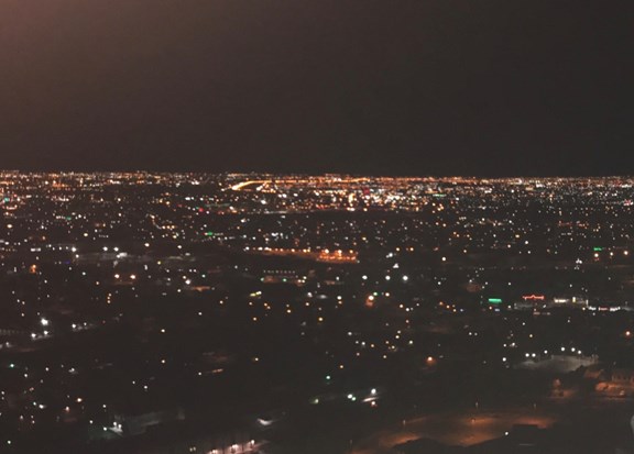
El Paso, Texas is located just 45 minutes from Las Cruces, New Mexico on Interstate 10. El Paso is a wonderful city full of history and beautiful mountains, and scenery. For great food, fun, and sites visit El Paso on your next visit to Las Cruces KOA.

A museum that focuses on the history of US Border Patrol dating back to the Old West, through the Prohibition, World War II, and the current high tech patrolling done today.
4315 Woodrow Bean Transmountain Rd
El Paso, TX 79924

Museum presents 14000 years of prehistory in the El Paso area, the greater Southwest, and even Northern Mexico. Museum has 15 acres of walking nature trails as well.
4301 Transmountain Rd
El Paso, TX 79924

About an hour's drive south of our campground, visit Wyler Aerial Tramway, Texas, which takes you to the top of Ranger Peak, elevation 5,632 ft, in the Franklin Mountains. Get a bird's-eye-view of New Mexico, Texas and Mexico all at once!
1700 McKinley
El Paso, TX 79930

The Caballo Mountains serve as a majestic backdrop for Caballa Lake State Park , which boasts a full array of water sports, winter waterfowl watching, and cactus gardens in bloom.
Hwy 187
Caballo, NM 87931

About an hour north of Las Cruces, Percha Dam State Park provides excellent fishing and bird watching along the river.
Hwy 187
Caballo, NM 87931
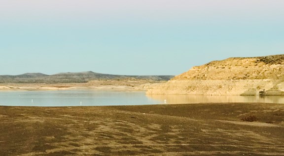
The largest and most popular lake in New Mexico, Elephant Butte Lake State Park provides a setting for every imaginable water sport. The visitor center offers regional interpretive exhibits. The mild climate of the area makes this park a popular year-round destination.
101 Hwy 195
Elephant Butte, NM 87935

The town - not the game - is located about 70 miles north on I-25. Famous for both its name and spas, we recommend a few places for day spa sessions: Charles Motel & Hot Springs, www.charlesspa.com, 575-894-7154; Fire Water Lodge Hot Springs Spa, www.firewaterlodge.com, 575-740-0315; La Paloma Hot Springs & Spa, www.lapalomahotspringsandspa.com, 575-894-3148; Riverbend Hot Springs at Mineral Springs Resort & Spa, www.riverbendhotsprings.com, 575-894-7625; and Sierra Grande Lodge & Spa, www.sierragrandelodge.com 575-894-6976. Soak yourself!

The Nuclear Age was ushered in with the world's first atomic detonation at Trinity Site Trinity Site on July 16, 1945. Trinity Site is located on the northern end of White sands missile range and is open to the public ONE day each year-the first Saturday in April.
That doesn't mean this area has to always be empty. When you start reviewing camping options, your history will display here to help compare sites and find the best stay. You will be able to share your stay information with friends or family and save it for a later time if you have a KOA Account.
Make checkout easy by booking all your reservations at once. Add your sites from different campgrounds into your shopping cart* and then choose checkout.