Your cart is empty!
Make checkout easy by booking all your reservations at once. Add your sites from different campgrounds into your shopping cart* and then choose checkout.
The following activities are in close proximity to Lemolo Lake/ Crater Lake North KOA:
Lemolo Lake/Crater Lake North KOA is located just 18 miles north of the North entrance to Crater Lake National Park. The unmatched beauty of this national park is a must see for any traveler through the region and is the only National Park in Oregon. The north entrance "typically" opens around June 1st of each year, but can fluctuate a few weeks either side of that date depending on snowfall in a given year. The North entrance closes on November 1st each year, unless snow fall closes it earlier. The website link for this section provides all the details on road conditions and other information you'll need before visiting Crater Lake National Park.
If the north entrance is not open when you visit the area, don't worry, the South entrance to the park is open YEAR ROUND and only adds about 45 minutes to your drive.
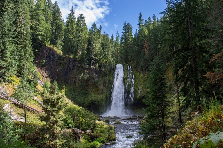
A local favorite and the tallest waterfall in the area at nearly 300 feet. This one is well worth the 15-minute hike from the parking area just off Highway 138. The trailhead is about 12 miles from the turnoff to our campground and is well marked along the highway with forest service signage. As one of the most popular waterfall hikes, quite a bit of parking is provided and it's configured so most large vehicles can get in and out.
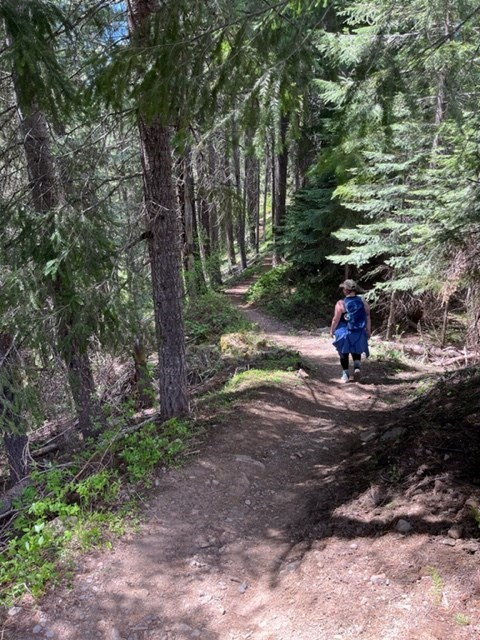
The North Umpqua Trail (locally known as the NUT). This popular trail for mountain biking, hiking and ultra-running has been featured in outdoor magazines as one of the best trails on the west coast. The most popular segment, the "dread and terror section" is located ½ mile from our KOA. In fact, multiple mountain biking and ultra-running races have used our KOA as starting or finishing points. Come see what enthusiasts already know. Some of the best hiking and biking in the world is found just outside our KOA's doorstep.

The Pacific Crest Trail, is a famous hiking trail that extends through the U.S. from the Mexico border to the Canadian border. A connection to the trail is located just a few miles east of our KOA.
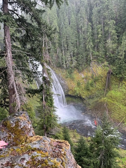
This fall has 2 separate hikes and viewpoints available. This description is for the Upper Falls Hike. The trailhead is across the Lemolo Lake Dam bridge and left along the canal about 1.5 miles from the campground.
The hike to the upper view of the falls is a beautiful hike along the North Umpqua Trail (& North Umpqua River). The hike is about 60-70 minutes each way from the trailhead. While the hike is beautiful, the view of the falls is not as spectacular as the lower falls view. This is viewed as a moderate hike in the difficulty spectrum. The parking area for the hike is for cars and trucks ONLY (NO RV's!).
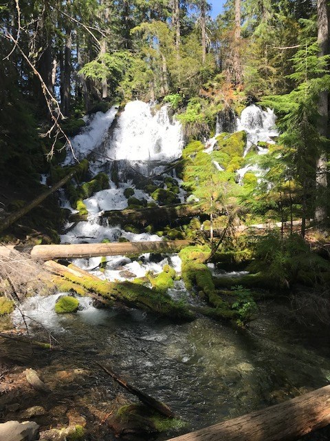
One of two waterfalls in our area available for even the hiking averse. Access to this waterfall is from Highway 138 about 3 ½ miles from the turnoff to our campground and is well marked along the highway with forest service signage. From the parking area the waterfall is a level 400-foot walk to the waterfall (sorry we can't consider it a hike). All but the Largest RV's can pull in and park at this fall.
Another local favorite and the only 2-tiered waterfall in the area with a 40-foot fall followed by an 80-foot fall. The 15-minute hike is an up and down walk with about 250 stairs involved each way. The parking area is about ½ mile off Highway 138 and the trailhead is about 14 miles from the turnoff to our campground and is well marked along the highway with forest service signage. Parking for about 20-30 vehicles is provided and can accommodate motor homes up to around 30 feet in the parking lot.

As the only hot springs in the area, Umppua Hot Springs has become a favorite for locals and travelers alike. The hot springs is about 4 miles NE of Toketee Falls waterfall on Road 3401 (dirt road). The falls are open from 6:00 am to 9:00 pm daily during the summer months (different hours in the winter months). A $5.00 day use is required. From the parking area, the hike to the hot springs is about 20 minutes . The hot springs feature 7 natural tubs in a cascading format (from upper tubs to lower tubs).Three items of note:
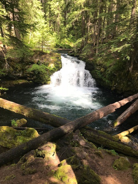
The Second of the two waterfalls in our area available for the hiking averse. Access to this waterfall is from Highway 138 about 6 ½ miles from the turnoff to our campground and is well marked along the highway with forest service signage. You can see the waterfall from the parking area. Is it considered a hike if you don't have to get out of your vehicle? Parking is a bit limited, but all but the Largest RV's should be able to pull in and park at this fall.
A hidden treasure that few people find as it's a little off the beaten path. Come to the store for directions before heading to this one as it's a little hard to find. But once you reach the trailhead, it's an easy 5-minute walk (not even a hike) in the shade to the falls. The trailhead is about 5 miles from our campground, and the roads are for cars and trucks ONLY.
This fall has 2 separate hikes and viewpoints available. This description is for the LOWER Falls Hike. The directions for the trailhead location can be a little confusing, so feel free to stop by the store for more detailed directions. The trailhead is about 3 miles from the campground.
The hike to the LOWER view of the falls is a down hill hike (going in) along a switch back trail. The hike is about 45 minutes down to the falls from the trailhead. Plan on 60-70 minutes back out as it is uphill the entire way. While the hike is not as beautiful as the UPPER Lemolo Falls hike, the pay off is when you get to the base of the falls, as the view of this large falls from the base is well worth the work getting there.
This is viewed as a difficult hike in the difficulty spectrum strictly for the lengthy up hill hike to get back out. The parking area for the hike is for cars and trucks ONLY (NO RV's!).
For this hike we recommend taking bug spray (mosquitoes love the wet mist at the base of the falls), drinking water and snacks.
That doesn't mean this area has to always be empty. When you start reviewing camping options, your history will display here to help compare sites and find the best stay. You will be able to share your stay information with friends or family and save it for a later time if you have a KOA Account.
Make checkout easy by booking all your reservations at once. Add your sites from different campgrounds into your shopping cart* and then choose checkout.